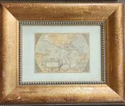
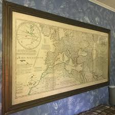
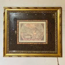
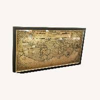
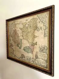
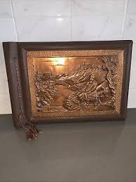
Antique World Map Print Value Guide
- Period
- 1700-1790
- Origin
- France
- Materials
- Paper, ink, wood, glass, gesso, gold leaf
- Category
- World map print
This 1700-1790 French World Map print is a quintessential example of the Age of Exploration's intersection between scientific cartography and high art. Originally serving as both a navigational record and a status symbol for the elite, these maps are highly collectible for their detailed copperplate engravings and historical depictions of the Old World.
What Is Antique World Map Print Worth?
The typical price range for Antique World Map Print is $300 - $400 based on recent sales. However, values can vary depending on the item's condition, rarity, and other factors such as:
- The physical condition of the paper, specifically the absence of foxing, water stains, or significant fading of the ink.
- The integrity of the original 18th-century style frame, including the preservation of the gold leaf and gesso details.
- The accuracy and detail of the French cartography, as maps depicting specific colonial expansions or rare geographic errors can command higher prices.
- The provenance and historical significance of the specific mapmaker or printing house active in France during the late 18th century.
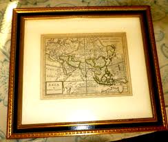
How to Identify Antique World Map Print?
- Verify the presence of a plate mark, a physical indentation in the paper caused by the copperplate printing process common in the 1700s.
- Examine the paper for hand-laid textures or watermarks consistent with 18th-century French production rather than modern smooth wood-pulp paper.
- Check the ornate frame for authentic gesso and gold leaf application, which should show age-appropriate wear or fine cracking known as craquelure.
- Look for specific French cartographic notations and stylistic flourishes typical of the 1700-1790 era, such as decorative cartouches and mythical sea creatures.
History of Antique World Map Print
World maps have been created since antiquity, with significant advancements made during the Age of Exploration. Early maps often combined geographical knowledge with artistic embellishments. The style of map in the image, with its detailed cartography and decorative elements, is characteristic of maps produced from the 17th to 19th centuries, reflecting the ongoing discoveries and colonial expansions of the era. These maps were not only practical tools for navigation but also status symbols, adorning the walls of wealthy homes and public institutions.
Shop Similar
HUGE Ancient Roman World Map - MASSIVE Old Map of …
etsy.com · $97
Gold Framed Vintage Map - Ocean Springs Mercantile
oceanspringsmercantile.com · $111
Antq World Map Shadow Catchers Wood 8lbs Ea Wall P…
ebay.com · $225
Restoration Hardware Old World Map - AptDeco
aptdeco.com · $350
FRAMED AUTHENTIC MAP OF DENMARK 1710 | eBay
ebay.com · $1000
ANTIQUE MAP OF H. MOLL ASIA WITH UNKNOWN PARTS CHI…
ebay.com.au
Related Items
Have an antique to identify?
Get an instant AI appraisal with values, history, and market insights.
Download for iPhone