Pan American World Airways Route Map Value Guide
- Period
- 1950-1960
- Origin
- United States
- Materials
- Paper, ink
- Category
- Route maps
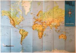
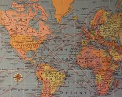
These mid-20th century route maps are iconic symbols of the Jet Age, illustrating Pan Am's dominance as the largest international air carrier in the United States. They are highly collectible for their detailed cartography of the 'Clipper' service routes across the Atlantic and Pacific oceans.
What Is Pan American World Airways Route Map Worth?
The typical price range for Pan American World Airways Route Map is $125 - $140 based on recent sales. However, values can vary depending on the item's condition, rarity, and other factors such as:
- Physical condition is paramount, with premium prices paid for maps without fold tears, foxing, or ink fading.
- The specific year of publication, as maps showing the transition into early Jet Age routes often command higher interest.
- Completeness, specifically if the map is still part of its original promotional flight packet or includes original airline inserts.
- Market demand for Pan Am memorabilia, which remains strong due to the airline's historical significance in American aviation.
How to Identify Pan American World Airways Route Map?
- Look for the official Pan American World Airways branding and the specific 'Clipper' service designations on flight paths.
- Verify the paper stock quality, which should be consistent with 1950s-1960s promotional flight packets.
- Check for the presence of mid-century typography and the specific blue and white color palette associated with Pan Am's corporate identity.
- Ensure the map accurately reflects the global flight network and destination hubs active during the 1950-1960 era.
History of Pan American World Airways Route Map
During the mid-20th century, Pan Am was the principal and largest international air carrier in the United States. These maps were often included in flight packets or distributed as promotional material to showcase the airline's 'Clipper' service across the Atlantic and Pacific oceans, representing the height of the Jet Age's expansion.
Shop Similar
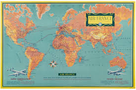
Original 1956 Mid-century Air France World Map Pos…
etsy.com · $475
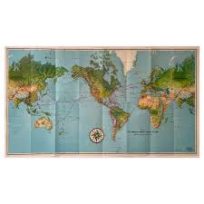
Pan American Airways 1952 World Route Map at 1stDi…
1stdibs.com · $750
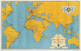
Chisholm Poster - Air France Route Map Yellow
vintagepostersnyc.com · $1850
ELAL ISRAEL NATIONAL AVIATION COMPANY ROUTE MAP ..…
ebay.com
Romania, 1980's, Vintage Flight Route Map - TAROM …
ebay.com
Map Digital Download 'bordering the Atlantic' - Et…
etsy.com
Related Items


Have an antique to identify?
Get an instant AI appraisal with values, history, and market insights.
Download for iPhone