Relief Map of Canada Value Guide
- Period
- 1920-1940
- Origin
- Canada
- Materials
- Plaster, paper, wood, paint
- Category
- Relief map
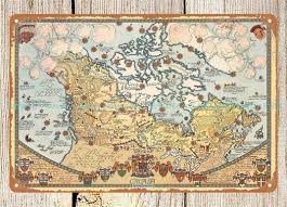
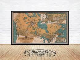
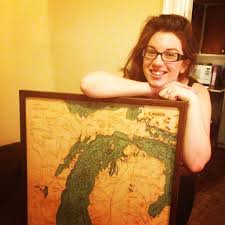
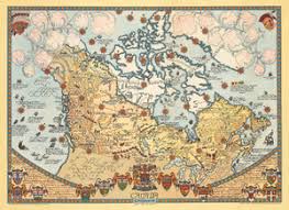
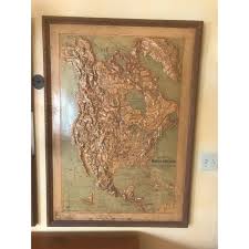
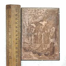
This antique three-dimensional relief map of Canada is a rare educational artifact from the 1920-1940 era, designed to provide a tactile understanding of the nation's vast topography. Meticulously crafted from plaster and hand-painted, it serves as a significant example of early 20th-century cartographic artistry used in private studies and classrooms.
What Is Relief Map of Canada Worth?
The typical price range for Relief Map of Canada is $500 - $700 based on recent sales. However, values can vary depending on the item's condition, rarity, and other factors such as:
- Physical condition of the plaster, as these maps are prone to chipping, cracking, or 'crazing' over time.
- Vibrancy and preservation of the original hand-painted colors used to denote elevation and geological features.
- Completeness of the original wooden frame and any identifying cartographic legends or titles.
- Rarity of the specific scale and the level of detail present in the three-dimensional rendering of the Canadian landscape.
How to Identify Relief Map of Canada?
- Check for a multi-layered construction consisting of a wooden base, plaster molding, and applied paper elements.
- Look for hand-painted details that define the western mountain ranges, central plains, and eastern coastlines.
- Verify the era by examining the political boundaries and place names consistent with 1920-1940 Canadian geography.
- Inspect the reverse side for original mounting hardware or educational supplier labels common to the early 20th century.
History of Relief Map of Canada
Relief maps became popular in the 19th and early 20th centuries as educational tools, offering a tactile and visual representation of landforms. This particular map of Canada would have been used in schools or private studies to help understand the vast and varied Canadian landscape, from its western mountain ranges to its central plains and eastern coastlines. These maps were meticulously crafted, often hand-painted, to provide an accurate depiction of elevation and geological features, serving as a testament to the cartographic artistry of the era.
Shop Similar
art prints 1964 pictorial map of Canada by Peter R…
ebay.com · $19
Old Pictorial Map of Canada, Literary Map, 1936, F…
etsy.com · $44
Below the Boat - Lake Michigan
belowtheboat.com · $375
Vintage Pictorial Map of Canada by Peter Fuse 1964…
nwcartographic.com · $450
Set of 3 Classroom Relief Maps - North America, Af…
chairish.com · $3000
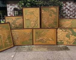
Antique Full Set of Atlas Relief Maps of the World…
etsy.com
Related Items
Have an antique to identify?
Get an instant AI appraisal with values, history, and market insights.
Download for iPhone