Daviess County Kentucky Map Value Guide
- Period
- 1968
- Origin
- United States
- Materials
- Paper
- Category
- Kentucky map
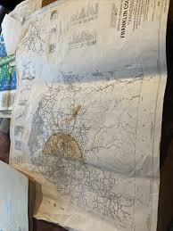
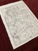
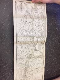
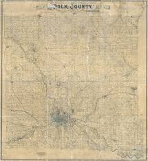
This 1968 map of Daviess County, Kentucky, is a significant piece of regional cartography produced by the local firm Johnson, Depp & Quisenberry Consulting Engineers. It serves as a detailed historical record of the county's infrastructure and transportation networks during a pivotal era of mid-century growth.
What Is Daviess County Kentucky Map Worth?
The typical price range for Daviess County Kentucky Map is $10 - $20 based on recent sales. However, values can vary depending on the item's condition, rarity, and other factors such as:
- Physical condition, including the presence of tears, foxing, or heavy fold lines.
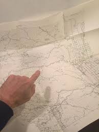
- The clarity of the engineering details and whether the ink remains vibrant and legible.
- Historical relevance to local Kentucky collectors or descendants of the engineering firm.
- Provenance, such as evidence of use in official local planning or surveying offices.
How to Identify Daviess County Kentucky Map?
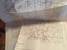
- Verify the 'Johnson, Depp & Quisenberry Consulting Engineers' credit line on the document.
- Check for the specific 1968 publication date printed on the map face.
- Confirm the paper stock is consistent with late 1960s engineering prints, typically a standard bond or blueprint-style paper.
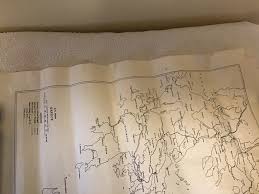
- Look for specific Daviess County landmarks and road networks as they existed prior to modern developments.
History of Daviess County Kentucky Map
Maps of specific counties, particularly those created by local engineering firms, offer a fascinating glimpse into regional development and infrastructure at a given time. This map would have been essential for planning, surveying, and understanding the local geography and transportation networks of Daviess County in 1968, reflecting a period of growth and change in Kentucky.
Shop Similar
Vintage 1978 Tn Dept Of Transportation Franklin Co…
ebay.com · $10
Vintage Map of Greece as of 1942. - Etsy
etsy.com · $10
1975 LARIMER COUNTY COLORADO FOLD OUT MAP Northern…
cyberdutchman.com · $10
MISSISSIPPI STATE GEOLOGICAL SURVEY Bulletin 71 ..…
ebay.com · $19
Tartary Map Antique Original Prevost 1758 Russia C…
sigedon.com · $70
THE CAMPAIGNS OF 1812, 1813, AND 1814. ALSO, THE C…
secondstorybooks.com · $324
Related Items
Have an antique to identify?
Get an instant AI appraisal with values, history, and market insights.
Download for iPhone