Grand Rapids Metro Area Map Value Guide
- Period
- 1950-1965
- Origin
- United States
- Materials
- Paper, wood, linen
- Category
- Local maps
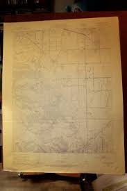
This mid-20th century Grand Rapids metropolitan area map captures a pivotal era of Michigan's urban expansion and infrastructure growth. Originally designed for municipal or educational use, these large-format wall maps are prized for their detailed topographical layouts and historical city planning accuracy.
What Is Grand Rapids Metro Area Map Worth?
The typical price range for Grand Rapids Metro Area Map is $140 - $155 based on recent sales. However, values can vary depending on the item's condition, rarity, and other factors such as:
- Physical condition of the paper and linen, specifically the absence of heavy foxing or water damage.
- The presence and integrity of the original wooden mounting hardware.
- Clarity and vibrancy of the topographical details and city planning annotations.
- Historical significance of specific neighborhoods or developments depicted during the 1950-1965 expansion period.
How to Identify Grand Rapids Metro Area Map?
- Check for a linen-backed paper construction typical of mid-century institutional cartography.
- Verify the presence of original wooden dowels or rollers at the top and bottom of the map.
- Look for specific 1950s-1960s infrastructure markers, such as early interstate planning or period-specific property boundaries.
- Examine the printing quality for the distinct lithographic or offset styles used by U.S. municipal map makers during this era.
History of Grand Rapids Metro Area Map
This map was likely produced for municipal or educational purposes during a period of significant urban expansion in Michigan. Such large-format wall maps were common in classrooms and government offices to track the growth of infrastructure and property boundaries in the mid-20th century.
Shop Similar
Harris County Rolled Sketch T1 | 6144, Harris Coun…
historictexasmaps.com · $20
Los Angeles Map 1915 - Nautical Chart Print - Etsy
etsy.com · $25
1900 Map of Calumet, Cook County, IL — High-Res | …
pastmaps.com · $29
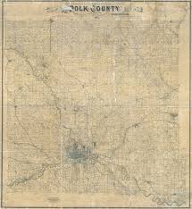
Buy 1885 Map of Polk County Iowa Des Moines Online…
etsy.com · ₹3278
Vintage 22" x 28" United States Geological Survey …
ebay.com
.jpg)
File:Spokane County Plat Map (May 1893).jpg - Wiki…
en.wikipedia.org
Related Items
Have an antique to identify?
Get an instant AI appraisal with values, history, and market insights.
Download for iPhone