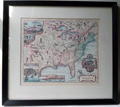
Map of Kent, Connecticut Value Guide
- Period
- 1874
- Origin
- United States
- Materials
- Paper, ink, wood, glass
- Category
- Map
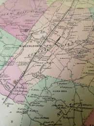
This 1874 map of Kent, Connecticut, is a significant historical document likely sourced from a late 19th-century county atlas. It serves as a detailed snapshot of the era, meticulously recording individual landowners, road networks, and local districts essential for property transactions and government record-keeping.
What Is Map of Kent, Connecticut Worth?
The typical price range for Map of Kent, Connecticut is $75 - $100 based on recent sales. However, values can vary depending on the item's condition, rarity, and other factors such as:
- Overall physical condition, including the presence of foxing, water stains, or tears in the paper.
- The quality and age of the wood and glass frame used for preservation.
- Legibility of the ink, particularly regarding the names of property owners and small geographical details.
- Provenance and historical significance of the specific county atlas from which the map was extracted.
How to Identify Map of Kent, Connecticut?
- Verify the 1874 publication date typically printed in the margin or title block.
- Look for the names of specific property owners and landmarks unique to Kent's 19th-century geography.
- Check for the characteristic paper texture and ink quality consistent with late 1800s lithographic printing.
- Examine the map for distinct district boundaries and road layouts specific to Litchfield County at that time.
History of Map of Kent, Connecticut
This map likely originates from a county atlas published in the late 19th century, a common format for documenting land ownership and geographical features during that era. These atlases were crucial for local government, property transactions, and historical record-keeping, often depicting individual landowners and important landmarks.
Shop Similar
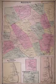
Midway - Range, Ohio 1862 Old Town Map Custom Prin…
shop.old-maps.com · $25
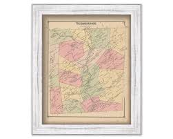
TUNBRIDGE, Vermont 1877 Map - Replica or Genuine O…
etsy.com · $41
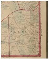
1877 Plat Map ~ RANDOLPH, PETHVILLE, SNOWSVILLE, O…
ebay.com · $49
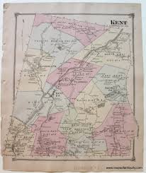
1874 - Kent, Connecticut *****SOLD***** - Antique …
mapsofantiquity.com · $95
1867 Original antique map of Wallingford,Connectic…
ebay.com.sg
Yarmouth Me - Etsy
etsy.com
Related Items

Have an antique to identify?
Get an instant AI appraisal with values, history, and market insights.
Download for iPhone