United States and Mexico Map Value Guide
- Period
- 1890-1915
- Origin
- United States
- Materials
- paper, ink, hand coloring
- Category
- United states mexico map
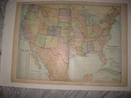
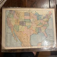
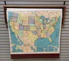
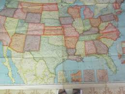
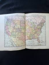
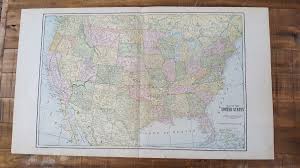
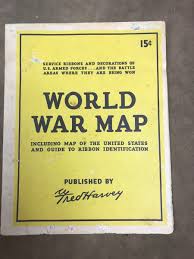
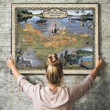
This late 19th to early 20th-century engraved map showcases the United States and Mexico with vibrant hand-tinted coloring typical of the era. Produced by renowned publishers like Rand McNally or Cram, these maps are highly collectible for their intricate cartographic detail and historical depiction of North American borders.
What Is United States and Mexico Map Worth?
The typical price range for United States and Mexico Map is $40 - $75 based on recent sales. However, values can vary depending on the item's condition, rarity, and other factors such as:
- Overall physical condition, including the presence of tears, heavy foxing, or significant fading of the hand-colored ink.
- The prominence of the publisher and the specific edition of the atlas from which the map was originally sourced.
- The clarity and preservation of the hand-tinting, as vibrant colors significantly enhance the decorative and market value.
- The integrity of original fold lines, which are expected for atlas maps but should not be excessively worn or separated.
How to Identify United States and Mexico Map?
- Look for the distinct plate mark or indentation around the map's border, characteristic of the engraving process.
- Examine the coloring for slight variations and overlaps that indicate manual hand-tinting rather than modern mechanical printing.
- Check for publisher names such as Rand McNally, Cram, or Tunison usually located in the margin or title block.
- Identify the paper type, which should be period-appropriate wove paper showing natural aging or light foxing.
History of United States and Mexico Map
Decorative engraved maps like this were commonly produced for atlases and wall charts in the late 1800s and early 1900s. Publishers such as Rand McNally, Cram, and Tunison issued colored county- and state-level maps printed from engraved plates and hand-tinted. These maps were used for education and reference in schools and homes and often bound into family atlases or issued as large pull-down charts. Over time they became collectible for their detailed cartography and antique coloring.
Shop Similar
ANTIQUE 1900 UNITED STATES DATED MAP INDIAN TERRIT…
ebay.com · $20
Boston Consignment | Maps | 2D6007
bostonconsignment.com · $75
Sold at Auction: Vintage Beckley-Cardy Co. Pull Do…
invaluable.com · $100
Vintage 1940 Cleartype ColorPrint Map of the Unite…
ebay.com.my
Antique World Atlas 1910-1919 Date Range Maps, Atl…
ebay.com
Antique North American Maps Nebraska 1920-1929 Dat…
ebay.com
Related Items
Have an antique to identify?
Get an instant AI appraisal with values, history, and market insights.
Download for iPhone