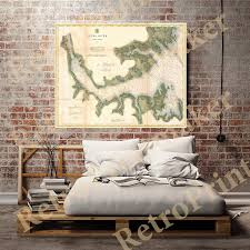
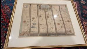
Nautical Chart of Narragansett Bay Value Guide

- Period
- Late 19th Century
- Origin
- United States
- Materials
- Paper, wood, glass
- Category
- Nautical chart
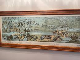
This late 19th-century nautical chart of Narragansett Bay serves as a vital historical record of Rhode Island's maritime legacy and naval importance. Meticulously updated to reflect shifting coastlines and navigational aids, these charts are highly sought after for their blend of scientific precision and aesthetic cartographic detail.
What Is Nautical Chart of Narragansett Bay Worth?
The typical price range for Nautical Chart of Narragansett Bay is $250 - $300 based on recent sales. However, values can vary depending on the item's condition, rarity, and other factors such as:
- The specific year of the update, with earlier late-19th-century editions often commanding higher prices.
- Physical condition of the paper, including the absence of foxing, water stains, or significant fading.
- The quality and historical accuracy of the wood frame and protective glass housing.
- The level of detail regarding local landmarks, shipping lanes, and naval installations within the bay.
How to Identify Nautical Chart of Narragansett Bay?
- Verify the late 19th-century publication date often found in the title block or lower margins.
- Look for detailed soundings and depth markers specific to the Narragansett Bay and Rhode Island coastline.
- Check for authentic paper aging and the presence of original lithographic or engraved printing marks.
- Examine the frame and glass for period-appropriate materials like antique wood and hand-blown glass characteristics.
History of Nautical Chart of Narragansett Bay
Nautical charts like this one were crucial for safe passage on the seas, especially in busy waterways like Narragansett Bay, a historically significant area for shipping and naval activity in the United States. These charts were meticulously updated over time, reflecting changes in coastlines, depths, and navigational aids. Collectors often value these maps for their historical insight and intricate details.
Shop Similar
Nautical Charts of Neuse River, North Caroline, NC…
etsy.com · $3
Lake Lucerne, Switzerland Map Print: 1948 Vintage …
etsy.com · $30
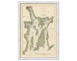
NARRAGANSETT BAY, Rhode Island - Nautical Chart by…
etsy.com · $42
1982 "Rush Hour Blizzard" Abstract Framed New York…
chairish.com · $405
Hiking Canoing Boundary Waters Custom Art Historic…
ebay.com · $922
rare pioneer mormon map route from Nauvoo to Great…
ebay.com · $34000
Related Items
Have an antique to identify?
Get an instant AI appraisal with values, history, and market insights.
Download for iPhone